
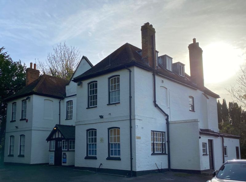
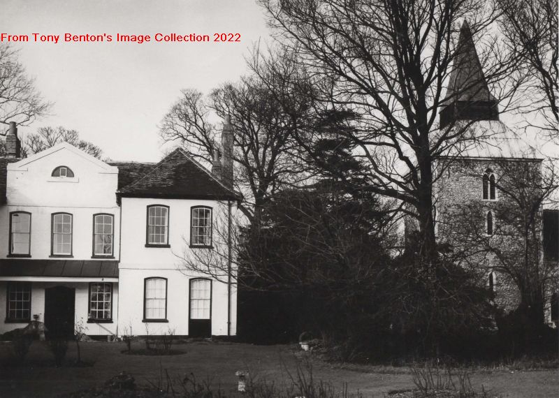
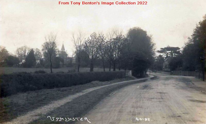
Most Upminster folk know that the building west of St Laurence Church, off Gridiron Place, is the former parish rectory, now used as offices, but many are probably unaware that until 1929 Upminster Park to the south of the church along Corbets Tey Road was the parish Glebe, the area of land which provided extra income for the Rector, alongside the tithes which were levied on the harvest from the whole parish.
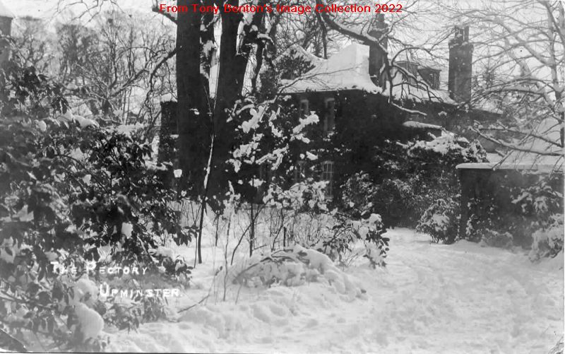
The present Grade II listed rectory was built by the Rector Rev Samuel Bradshaw soon after he took over the parish in 1735. It replaced the ruinous rectory on the same site which his predecessor, the Rev William Derham had refused to live in, preferring instead to rent and occupy High House opposite the church.
The original rectory (or parsonage house as it was then called), was already said to be in a poor state over a century earlier. A survey in 1610 recorded that it comprised “seven upper, and six lower Rooms, a Brew-House, Larder, and Milk-House Chamber’d over, a Dove-House, Stable, Hen-House, Barn, Hay-House, and two Cottages, one upon the side of the Church-Yard, the other upon the High-way, and Orchard with a Pond, of half an Acre, one Garden, a Court before the House, and a Kitchin-Garden; and about 16 acres of Glebe.”
The new rectory was first referred to in 1740 when the Essex historian Nathaniel Salmon wrote that the Rev Bradshaw “has built an elegant parsonage house”. The rectory has cross-wings with two storeys and is built of red brick. Its H-plan, which would have been old-fashioned when it was built, together with its single storey centre, harks back to a medieval design. It has a tiled roof, which is hipped over the projecting wings, while the central brick porch is modern. Bradshaw certainly lived in his new rectory, as did his later successors, the famed Holden family.
The rectory site was originally moated, with the moat about 30 feet wide and stretching to about 400 feet north and south by 200 feet east and west. Upminster’s historian T L Wilson said that about 40 yards of this moat remained on the north east of the premises until 1810 and a portion on the south west was still in existence in 1881. This was probably the water feature which still appeared on early 20th century Ordnance Survey maps.
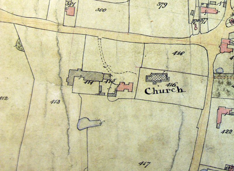
(The National Archives IR 30/12/356)
We can get an idea what the interior of the rectory was like in February 1862 after the death of the Rev John Rose Holden when its contents were advertised for sale. The drawing-room and library were said to contain handsome rosewood and other tables, a knee-hole writing desk, and sofas and chairs, while the dining room was furnished with mahogany chairs and a leather-covered easy chair. Among the bedroom furniture were lofty mahogany four-poster beds, mahogany chests of drawers, “two patent portable water-closets” and rush-seated chairs.
Before the Rev Philip Melancthon Holden took over the Upminster living in July 1862 the rectory had undergone “thorough repair to [his] satisfaction”. Although we don’t know what changes were made then the works were carried out by a company from Hammersmith, Messrs Wescombe, Wilson and Kipping, with whom the Rector seems acquainted from his time as a curate in that parish.
In July 1863 another step taken by the incoming Rector was to sell the rectory’s two adjoining “timber-built and reeded” barns, one 29 feet by 12 feet 6 inches on brick foundations, while the adjoining smaller one had a stone-floor. The brick foundations and a quantity of building materials were also included in the purchase. The larger of the two barns had been Upminster’s real tithe-barn, where the harvest produce claimed by the Rector from parishioners was stored. The smaller barn abutted to the east on the Rectory stables and the purchaser was required to make good any damage which occurred to the stables during demolition.
Tithes were an obligation to the church from the mostly land-holding parishioners to provide one tenth of their produce to support the clergy. The obligation was required “in kind”, with the Rector or his appointee collecting from each farm the tenth sheaf of corn, tenth pail of milk, tenth cow etc., with such produce was stored in a tithe barn, as mentioned above. Over time this practice was replaced by fixed payment system of cash in lieu which was the case in Upminster until the Rev John Rose Holden senior felt that he was being short-changed and decided to insist on collecting tithes in kind. This decision caused much local friction, leading to a lawsuit in 1801, which can be read about in detail in other Upminster histories.
Under the Tithe Commutation Act of 1836 tithes were abolished and by law were converted into rent charge payments. Tithe Commissioners were appointed and they employed surveyors who produced a detailed map of land holdings in the parish and a schedule or agreement which apportioned charges for each parcel of land, identifying each owner and occupier. Upminster’s tithe was assessed in 1842 to be a payment of £1052 to the Rector. The resulting accurate large-scale map of the parish is considered to be the finest map of Upminster, and it is one of the biggest tithe maps in the Essex Record Office.
The tithe barn was therefore redundant but found one final role in 1861-2 when it was used for church services during the rebuilding of St Laurence Church. Dr Thomas Harding Newman of Nelmes, Hornchurch bought the barns and had two months to dismantle the barns and clear them away. These materials were eventually re-used before 1870 to construct Tharp Lodge on Butts Green Road in Hornchurch.
After the Rev P M Holden’s death in 1904 there was again a sale by auction of the rectory contents which then included “mahogany bedroom appointments, bedsteads and bedding, drawing-room settees, couches and tables, fine carved oak furniture, including sideboard, dinner wagon, dining table, chairs, bookcase, occasional tables etc”. There were also “Turkey, Aubusson, and Brussels carpets, a large iron safe by Hullmaker, bronze marli horses, clocks and candelabra, a few pictures and prints, plater articles, chimney glasses and mirrors.”
In 1910 the rectory was said to have three attics, three bedrooms, a nursery and “night rooms”, a bathroom, two reception rooms, a study, a kitchen and scullery. Outside there was a stable, coachhouse, chicken houses and cowsheds. In 1911 the 12-room rectory accommodated the new Rector, the Rev Hyla Henry Holden, his wife, their four children aged between four and ten, a visitor, and three servants – a housemaid, a nursemaid and a house boy. Ten years later in 1921 the Holdens and their three children who living at home, were now served by only one live-in cook, whose five-year-old son also lived with her.
The pleasantly-wooded rectory garden was often a popular venue for local celebrations including particular the annual May Queen Festival held from 1913 onwards and an annual Upminster Pound Day, a fund raising fete for the Romford Cottage Hospital.
The rectory remained the home of Upminster’s rectors until the 1970s, when a modern rectory was built to the south, and the former rectory was converted into offices, renamed St Laurence House, and given the address 2 Gridiron Place. In the 1990s much of the rectory garden was sold for development with the newly-built 18 flats Nos 1-35 Gridiron Place erected and occupied from around early 1995 onwards.
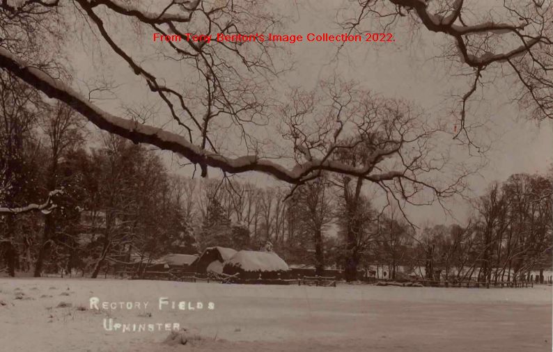
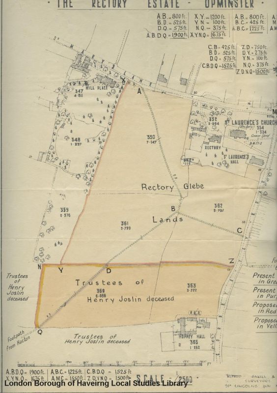
South of the rectory and the parish church was the parish Glebe, which was an area of land farmed or leased out by the Rector to provide him with extra income, over and above his annual income from the parish tithes.
The Upminster Tithe Survey of 1842 assessed the Glebe at just over 20 acres, compared to the 16 acres recorded in 1610. Of this area, the Rector held seven acres of the Glebe, running south along Corbets Tey Road, in 1842, while the remaining 13 acres or so were mainly pasture, plus the tithe barn and adjacent yard. These were leased to Joseph Lee, a former publican of the Bell Inn and by now land steward of Sir Thomas Neave. Lee lived at Oak Place in Cranham Lane (St Mary’s Lane), where he leased further pasture. He was still leasing the Glebe barns and pasture in 1848 but it’s not known what happened after his death although the following year, all his farming equipment was sold by auction along with his livestock, suggesting that the pasture had a new tenant.
The two cottages, mentioned as being on the Glebe in 1610, stood there until the first decade of the 19th century when they were removed due to their very dilapidated condition. The Rev Derham had planted many fine elms on the Glebe during his incumbency and in 1881 Wilson said that twenty-two of these remained on the St Mary’s Lane side, one of which exceeded 16ft in circumference. None now remain, as any surviving elms eventually succumbed to Dutch Elm disease.
Two rights of way ran across the Glebe. One footpath ran from just east of Hacton House, across the field behind Hoppy Hall and crossed the Glebe in a north-easterly direction. Another ran footpath from St Mary’s Lane, east of Hill Place (which later became the Convent) south east across the Glebe; the two paths merged to run east to join Corbets Tey Road.
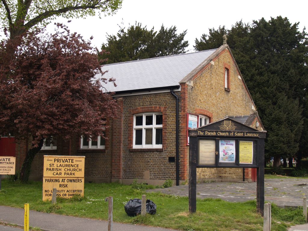
In November 1912 the parish congregation agreed to support a proposal that a parish hall should be provided on the Glebe to the south of the churchyard. J.Barker & Co of Plaistow were engaged to carry out the works and plans were submitted to the Romford Rural District Council on 3rd October 1913, and approved on 23rd December that year. The initial proposal for an iron hall 50 feet by 25 feet, costing around £400, had evidently changed significantly as the final plans were for a hall built of stock bricks, with red brick facings and Bathstone coping, accommodating 400. Work on clearing the ground started in early January 1914 and within just four months the newly completed St Laurence church hall opened on 9th April 1914, at a final cost of just over £1000 including fittings. The Bishop of Barking performed a dedication ceremony and Mrs Robertson of Hacton House formally declared the hall open. Within four months, however, the hall was pressed into emergency service as a twelve-bed hospital as part of the war effort to serve as a convalescent home for the care of wounded servicemen discharged from larger hospitals.
From the summer of 1919 new uses for the Glebe were proposed. In August 1919 the parish council suggested that the part of the Glebe bordering Corbets Tey Road might be suitable for shopping but nothing came of this. In response to the national drive to improve the housing stock to provide “homes fit for heroes” the idea of buying the Glebe to build council cottages was put forward. In early 1920 the Romford Rural District Council were in negotiations with the Church Commissioners’ agents Kemsleys to buy the Glebe and build workmen’s housing on the road frontages and sell the land at the rear to the Upminster Parish Council for a recreation ground. The District Council agreed in October 1920 to seek a loan to buy the road frontages to build housing but this plan had fallen through by early 1921. The Parish Council also attempted to negotiate with Kemsleys but they were unwilling to pay the agents’ £3,900 asking price.
In early 1920 the Rector Rev Hyla Henry Holden, who was a keen sportsman and captain of Upminster Cricket Club, had arranged for them to relocate their ground from Hall Lane to part of the Rectory Meadow on the Glebe, with the club’s pavilion, an old railway carriage, moving to the new site. A key issue for the club was preventing the cattle grazing on the Glebe from damaging the wicket and they had been able to buy iron wicket fencing to keep the cattle away and to improve the pitch and the Glebe became their permanent home.
The Glebe was still unsold by 1925 when a special meeting of the sports clubs already playing on the Glebe meadows agreed to investigate buying the land. They made an offer to the Rector and enquired about diverting the public footpaths which ran across the Glebe. By January 1926 a purchase price had been agreed with the Ecclesiastical Commissioners and by the end of 1926 they had obtained the Romford Rural District Council’s approval to divert the footpaths. However, discussions with the Parish Council dragged on before the footpath diversion plan was finally approved in June 1928.
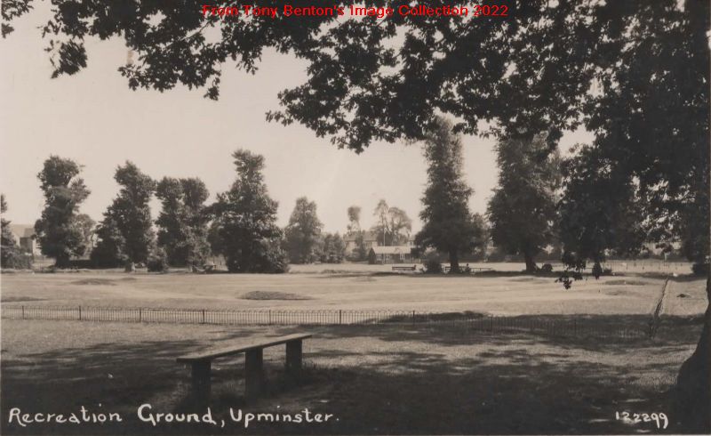
Nothing came of the sports clubs’ purchase, however, and soon afterwards the Parish Council reopened negotiations which finally led to success. At the Parish Meeting on 25th March 1929 approval was finally given to buy the whole 18 ½ acre Glebe for recreation. In May 1929 the Parish Council applied to the Ministry of Health for a £6,000 loan to cover the £5,250 costs of purchase plus the costs of fencing the site and carrying out the necessary works. The Ministry of Agriculture and Fisheries approved the sale to the Upminster Parish Council in August 1929 and the council’s receipt of the loan allowed the purchase of the site to be completed on 27th November 1929.
Although the cricket ground had received regular attention, other parts of the Glebe needed work to get them in shape. Areas needed to be levelled, trees and hedges removed, ditches filled in and additional fencing erected over the next year or so. The parish enthusiastically supported the plans, and the Ratepayers Association provided benches and new trees at each of the four gates into the park. In April 1930 the Council reached agreement with the Upminster Cricket Club, the tennis club, three local football clubs and the hockey club for hire costs for the use of the new pitches.
Upminster became part of the Hornchurch Urban District Council in April 1934 and the recreation ground came under new management. The cricket pavilion had burnt down in May 1933, and the Urban District Council agreed to replace it in time for the 1935 season. The UDC then completed a survey of the ground and agreed plans for a new layout, including a plan to relocate the football ground from the area alongside Corbets Tey Road. These plans, which were presented to the UDC in 1937, included two hard tennis courts, a car park, a children’s playground, paths, fencing and seats at a total cost of £1365.
The outbreak of war in September 1939 put a stop to the developments but the recreation ground was one of the few open spaces which remained open for general recreation. Only the north-east quadrant (near the old village hall on the Corbet’s Tey Road frontage) was pressed into war service with two underground public air raid shelters developed. Two gas decontamination buildings and an Air Raid Precautions building were built on the St Mary’s Lane frontage, as was a “British Restaurant” – a communal kitchen for people who had been bombed out of their homes which it is believed later became the old Windmill Hall) – which opened in March 1943.
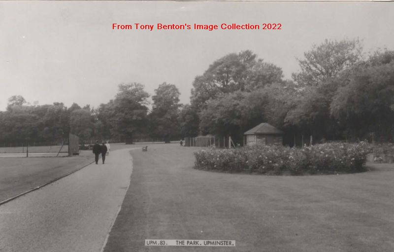
After the war ended the pre-war plans were dusted off. From 1947 the footpaths were provided, two grass tennis courts were converted to hard courts, with two further courts converted in 1953/54. The site of the bomb shelters became ornamental gardens in 1948 and additional playground equipment was provided in 1951/2. The transfer to the new Hornchurch Stadium of the renamed Upminster & Hornchurch Football Club from 1952 finally allowed the pre-war plans for former football pitch adjoining Corbets Tey Road to become a casual use area.
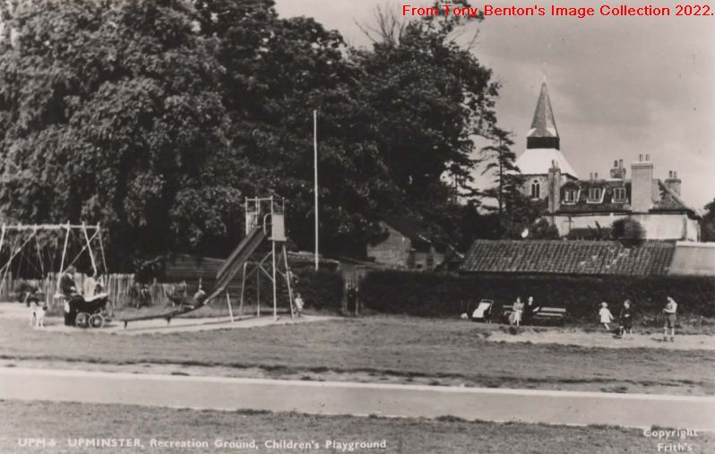
It seems that five staff were employed at the recreation ground during the 1960s: one first class and one second class gardener, a labourer, and two park attendants. The removal of the fence and hedge along the Corbets Tey boundary in the 1960s gave the Park its open frontage. In the 1980s the children’s playground was relocated to its present location by the tennis courts.
In May 1959 the imminent purchase from the Church Commissioners of a site in Corbets Tey Road, between the St Laurence’s Church Hall and the recreation ground, was reported. By 1961 the purchase had been completed and public conveniences had been built, and work had begun on a new, purpose-built library costing £42,000. The new Upminster library, which replaced that in the Clockhouse, opened on Thursday 24th October 1963. Over 10,000 library users visited the new Upminster Library on that day, with 3,862 books issued by the hard-worked librarians!
After the war the British Restaurant was established as the Windmill Hall, community social hall. By the mid-1960s this was destined for demolition and the adjacent New Windmill Hall was built in 1968. Despite the threat of demolition hanging over the Old Windmill Hall, the ultimate decision to demolish only came in 2011 and it was gone by 2013. Millstone House (McCarthy & Stone) retirement flats were built on the site of the hall and car park and were completed in 2018.
The Friends of Upminster Park, formed in 2004, have subsequently raised considerable funds to support further improvements to the Park’s facilities.
Main Sources
Hornchurch Urban District Council: Report of the Surveyor to the Pleasure Grounds, Fire Brigade and Ambulance Committee on the Parks and Recreation Grounds owned by the Council 29th January 1937
Thomas Lewis Wilson History & Topography of Upminster (1881) pp 58, 102-104
W.R. Powell “Upminster” in A History of the County of Essex: Vol 7 (1978) pp.156-161
Upminster Parish Council & Parish Meeting Minutes 1916-1935 (Havering Local Studies Library)
The Upminster Local History Group: The Story of Upminster Book 8: Church and Rectors pp19-23 (June 1959)
The Upminster Local History Group: The Story of Upminster Book 14: The Development of Modern Upminster pp12-14 (December 1962)
Tithe Commissioners Upminster Tithe map & Apportionment (Essex Record Office D/CT 376 A & B and The National Archives IR 30/12/356 & IR 29/12/356)
